NeighborhoodEast IslesCedar-Isles-DeanLake of the Isles
The Bridges of Lake of the Isles, and What They Carry
The little arched crossings between the bays are more than postcard scenery; they stitch the neighborhood's daily life together.
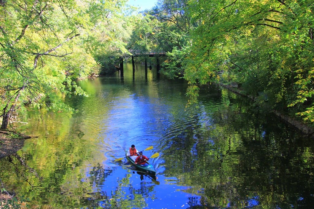
Lake of the Isles has a geography of inlets and bays that most city lakes lack, and that geography has always required bridges. The arched pedestrian crossings that span the narrow channels are among the most photographed features of the neighborhood, the kind of view that turns up on postcards and engagement photos alike. Their real value, though, is functional, and it is on display every morning long before the photographers arrive.
Small Crossings, Heavy Use
Each morning the bridges carry a steady current of runners, dog walkers, parents pushing strollers and commuters cutting through on foot. They knit the eastern shore in East Isles to the western parkway and on toward Cedar Lake, turning what could be a string of disconnected segments into a single continuous loop. Remove one crossing and the loop stops being a loop; the bridges are the stitches that hold the walk together.
That connective role is why the crossings show up in the Park Board's long-range Plan for Cedar Lake and Lake of the Isles, which treats the circulation network, paths, bridges and access points, as infrastructure to protect and improve rather than scenery to leave alone. The plan even contemplates new and rerouted paths to strengthen the chain's connectivity, with the bridges as fixed anchors.
Maintenance Most People Miss
Because they are old and heavily used, the crossings need steady attention, the kind of railing repair and deck work that rarely makes the news. The Park Board folds that upkeep into its broader stewardship of the Chain of Lakes Regional Park, which draws on the order of seven million visitors a year across its lakes, a level of foot traffic that wears hard on any structure.
Maintenance on a heavily loved structure is a race against its own popularity. Every crossing photographed at golden hour is also a crossing pounded by thousands of feet a day, and the two facts are inseparable. Keeping a railing solid and a deck sound is the unglamorous price of a lake this used.
Why It Is Worth It
Stand on one of the bridges at dusk and the appeal is obvious. So is the wear. For the neighborhood, the crossings are less a set of photo backdrops than a daily convenience: the difference between a continuous waterside walk and a series of dead ends.
A Crossing the Plan Protects
The Cedar-Isles plan the Park Board approved in 2023 treats the loop's circulation network as something to maintain and strengthen, not merely preserve, and the bridges are fixed points in that network. Where the plan contemplates new or rerouted paths to improve the chain's connectivity, the existing crossings are the anchors everything else is routed around, which is part of why their upkeep is treated as core infrastructure rather than optional charm.
For residents, that distinction matters. A bridge closed for repair, even briefly, severs the loop and forces a detour that ripples through every morning run and dog walk on that side of the lake. Keeping the crossings sound is therefore less about postcards than about preserving the seamless, continuous walk the neighborhood has organized so much of its daily life around.
There is also a quiet equity in keeping the crossings sound. A loop that depends on a few narrow bridges is only as accessible as those bridges are safe and even underfoot, and steady deck and railing work keeps the route usable for the strollers, wheelchairs and older walkers who rely on a smooth, continuous path as much as any runner does.
That is the quiet bargain the bridges represent. They ask for steady, unseen care, and in return they give Lowry Hill and East Isles a loop that actually connects, season after season, one short span of arched stone and rail at a time.
NeighborhoodEast IslesCedar-Isles-DeanLake of the Isles
Related stories

Neighborhood
Lowry Hill and East Isles Land on Patch's List of Minnesota's Most Expensive Neighborhoods
Lowry Hill and East Isles rank among Minnesota's most expensive neighborhoods according to Patch's analysis of Niche's 2026 data.

Neighborhood
Community celebrates Lake of the Isles Pencil's 5th sharpening
Thousands gathered in East Isles on June 6, 2026, to watch the annual ceremonial sharpening of Minneapolis' giant pencil sculpture.

Neighborhood
The end is in sight for Loring Park dandelion fountain's drought
State lawmakers approved $1.8 million for Berger Fountain repairs, and Park Board crews have begun demolition at the dry Loring Park landmark.
The neighborhood, in your inbox
Free. No paywall. Pick the topics you want — we send what’s happening this week.