NeighborhoodLowry Hill East (The Wedge)
Streetcars to Apartments: How the Wedge Got Dense
The Wedge developed in the 1880s along Thomas Lowry's streetcar line, and the density it set then still defines the neighborhood.
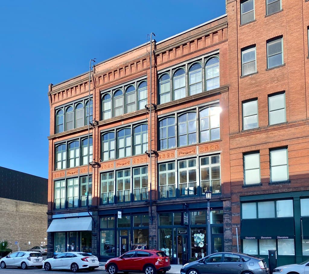
The Lowry Hill East neighborhood — the Wedge — developed in the 1880s along a horse-drawn streetcar line built by Thomas Lowry, the transit magnate and real-estate developer for whom it is named. A streetcar line was established along Lyndale Avenue in 1884, part of the system Lowry pioneered, and the electric streetcars that followed set the triangle between Hennepin and Lyndale on a path toward dense, transit-oriented living.
The neighborhood takes its nickname from its wedge shape: bounded by Lyndale Avenue on the east, Hennepin Avenue on the west and Lake Street on the south, narrowing to a point where the two avenues meet near Interstate 94. From the start it developed differently from the mansion district of Lowry Hill across Hennepin. Where Lowry Hill filled with large houses on generous lots, the Wedge layered walk-up apartments and smaller houses into a compact, walkable grid that put workers within reach of a streetcar stop.
That early pattern persisted. The interior today mixes large early-20th-century homes with multi-unit apartment buildings — including 20-plus-unit buildings put up in the 1920s and 1930s — while the border streets carry bars, restaurants, coffee shops and grocers. As of 2020 the neighborhood had 9,298 residents at about 22,600 people per square mile across roughly 0.41 square miles, one of the densest neighborhoods in Minneapolis, and most of its housing is renter-occupied.
The logic that built the Wedge — concentrate housing where frequent transit runs — is the same logic behind today's debates over the Hennepin and Lyndale corridors. The recently rebuilt Hennepin Avenue, with its dedicated bus lanes, echoes the streetcar spine that created the neighborhood. New buildings continue to rise on the old streetcar blocks, and the Lowry Hill East Neighborhood Association (thewedge.org) spends much of its energy shaping how that density arrives. The Wedge is not being asked to become a transit neighborhood; it has been one for nearly a century and a half. The open question is how much more density it adds, and where.
NeighborhoodLowry Hill East (The Wedge)
Related stories

Neighborhood
Lowry Hill and East Isles Land on Patch's List of Minnesota's Most Expensive Neighborhoods
Lowry Hill and East Isles rank among Minnesota's most expensive neighborhoods according to Patch's analysis of Niche's 2026 data.

Neighborhood
Community celebrates Lake of the Isles Pencil's 5th sharpening
Thousands gathered in East Isles on June 6, 2026, to watch the annual ceremonial sharpening of Minneapolis' giant pencil sculpture.

Neighborhood
The end is in sight for Loring Park dandelion fountain's drought
State lawmakers approved $1.8 million for Berger Fountain repairs, and Park Board crews have begun demolition at the dry Loring Park landmark.
The neighborhood, in your inbox
Free. No paywall. Pick the topics you want — we send what’s happening this week.